Workbench: SIOSE Zoning
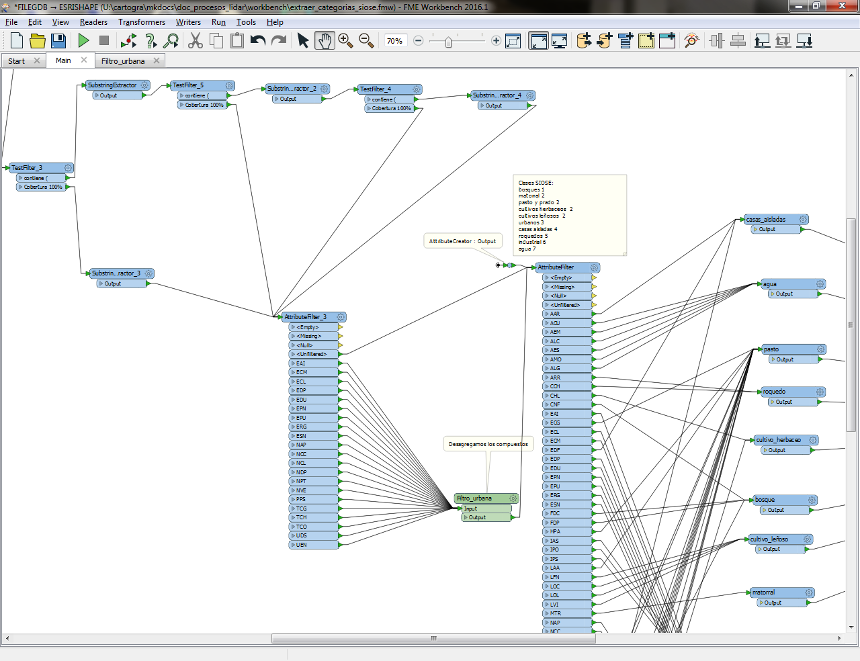
The FME workbench 'extraer_categorias_siose.fmw', is used to establish the zoning of the LiDAR work blocks, based on the simplified categories of the The Spanish Land Use and Land Cover Information System (SIOSE).
In this process, the geographic area of each LAS file is divided based on the following typology of classes, generated from a thematic simplification of the SIOSE layer.
- Forest (1)
- Scrub, grass, meadow, arable crops and tree crops (2)
- Urban (3)
- Isolated houses (4)
- Rocky areas (5)
- Industrial (6)
- Water (7)
Note: All project workbenchs are kept updated in the GitHub repository https://github.com/iderioja/clasificacion_lidar. You can consult it directly or synchronize it with git.