Download data: OGC services WMS/WFS
The LiDAR information is managed in IDErioja Spatial Database. It allows to offer geographic information and its associated files through OGC Services.
In the case of LiDAR information, a specific WMS (Web Map Service) visualization service has been configured, whose url is: https://ogc.larioja.org/wms/lidar/request.php and a data download service WFS (Web Feature Service), in the url: https://ogc.larioja.org/wfs/lidar/request.php. Both services are part of the Spatial Data Infrastructure of Spain (IDEE).
All geographic layers offered through these OGC services contain attributes that include download links to files in LAS / LAZ formats and additional technical documents.
These WMS / WFS services can be accessed through standard GIS clients (heavy clients) that implement these OGC protocols (QGIS, gvSIG, ArcGIS, GeoMedia... and others).
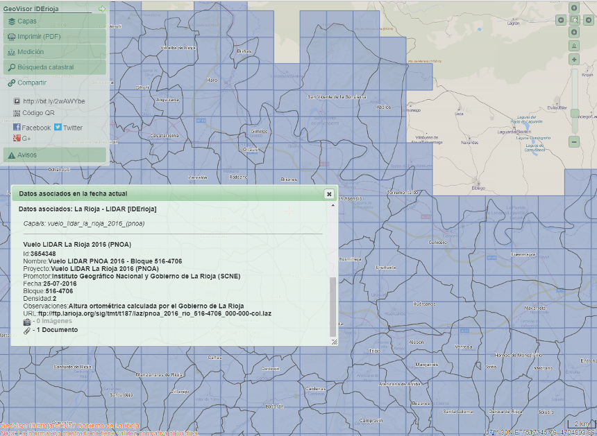
The WMS service can also be accessed through an HTML interface (thin client), capable of sending a request for information of type GetFeatureInfo.
IDErioja GeoViewer is a geospatial platform developed by the Government of La Rioja, fully configurable, designed to consult WMS services.
In this viewer, when you click on a point on the map, you get the information associated with all the elements in that position.
In the case of the WMS IDErioja services for LiDAR you are presented the urls to download these data sets